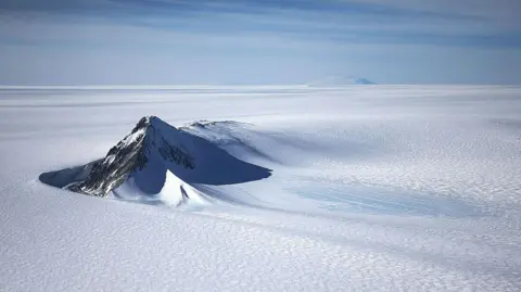
Researchers have unveiled a highly detailed new map of the landscape beneath Antarctica's ice, revealing an array of features and providing crucial insights into how climate change may affect the region.
Using advanced satellite data, scientists have outlined thousands of previously hidden hills and ridges, enhancing our understanding of the continent's topography.
These new maps offer an unprecedented view of Antarctica's subglacial landscape, which could help predict the continent's behavior in terms of its contribution to sea-level rise.
Dr. Helen Ockenden of the University of Grenoble-Alpes, one of the study's lead authors, likened the discovery to upgrading from a grainy camera to a high-resolution digital image, stating, It's amazing to see the whole bed of Antarctica at once. The new findings are crucial as more is known about the surface of other planets than about much of Antarctica's subsurface topography.
Traditionally, researchers relied on sporadic measurements using radar to survey beneath the thick ice, leading to gaps in knowledge. The new approach utilized satellite data combined with physics of glacier movement to provide a comprehensive view of what lies beneath.
Notable discoveries include a deep channel located in the Maud Subglacial Basin, measuring 50 meters deep and spanning approximately 400 kilometers in length.
Although this new map is based on certain assumptions about ice flow, the research is expected to play a pivotal role in furthering our understanding of how these pivotal landforms influence glacier movements and retreat, thus informing predictions about future sea-level rise.
The study is published in Science, and researchers emphasize that this map, while detailed, is just the starting point for understanding the complexities of Antarctica's subglacial landscape.