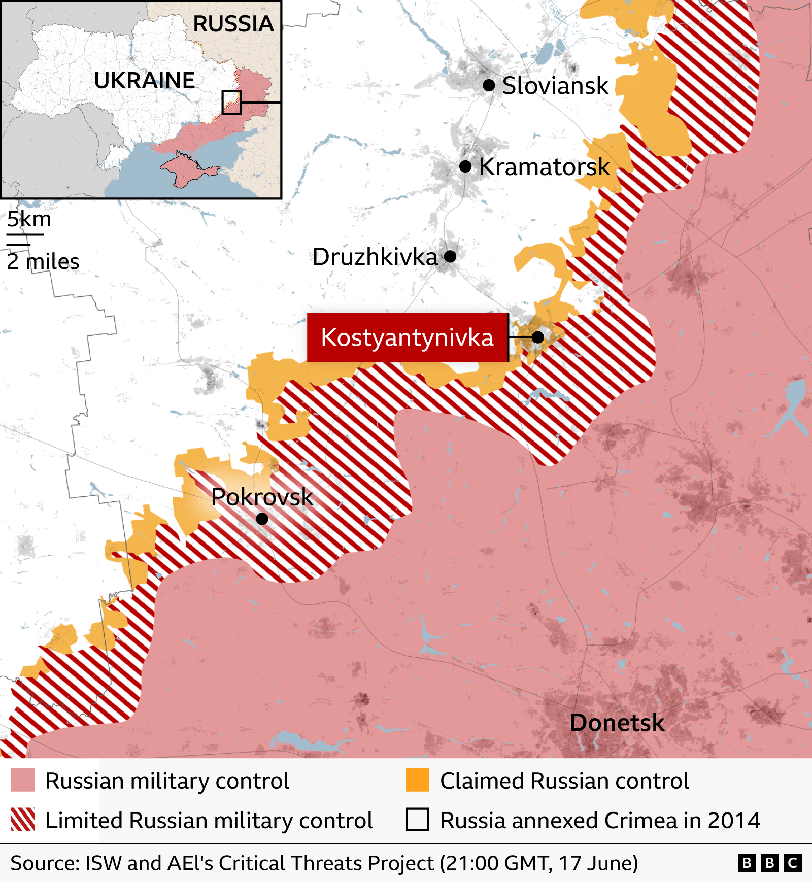
Russian forces have carved a foothold in Kostyantynivka, a small city on a vital corridor to Ukraine’s Donbas. With troops pushing from both the south and the north, the city has slipped into what Ukrainian officials call a “grey zone” where no single side controls the streets.
Strategic Significance
Kostyantynivka lies on the main axis that connects the Russian border to the occupied region of Crimea. If the city were to fall, Moscow could use it as a springboard toward the remaining eastern strongholds of Kramatorsk and Sloviansk, bringing the entire Donbas area within its grasp.
Ukrainian Perspective
Ukrainian commanders claim the city’s situation remains “under control,” yet admit that some 130 Russian soldiers still occupy parts of the town. An unnamed drone pilot explains that each building can hide soldiers, and without the ability to identify and neutralize Russian drone launch sites, Ukrainian forces face constant pressure.
Russian Claims
Moscow officials state that its troops have rapidly advanced into the south‑western part of the city and encircled Ukrainian units. The Russian defence ministry has released footage showing soldiers on the ground, implying a swift takeover.
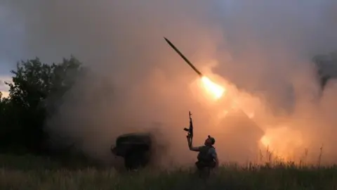
Logistics and Drone Warfare
Both sides rely heavily on drones: Ukrainian crews target enemy infantry but lack the resources to pursue Russian pilots, while Russian units use cheaper Chinese drones to monitor Ukrainian launch sites. Delivery of supplies across the field has become increasingly hazardous, with land routes under constant attack and even large logistical drones intercepted.
Implications for Donbas
If Kostyantynivka falls, Ukrainian logistics in the area will be severely crippled, making the already contested Kramatorsk “extremely dangerous.” Ukrainian forces report a shortage of reinforcements and a reluctance among commanders to publicly admit losses, hinting at a fragile front line.
Source: BBC News