In brief
Satellite imagery and on‑site footage confirm that the TPM tanker Gem No. 2 was struck outside the Strait of Hormuz, releasing oil that has drifted onto beaches near Umm Al Quwain. The spill has already covered more than 35 km of coastline and reached sensitive marine habitats, including the Key Biodiversity Area around Siniyah and Khor Al Beidah islands. UAE authorities have begun containment efforts, but environmental experts warn that the long‑term impact could be severe due to the toxic hydrocarbons involved.
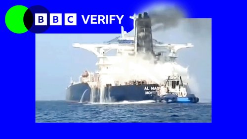
Satellite imagery and footage show a crude oil tanker near the Strait of Hormuz that was struck by a projectile on 9 October. The vessel, later identified as Gem No. 2, sustained a breach that has released a slick of heavy crude onto the Gulf of Oman.
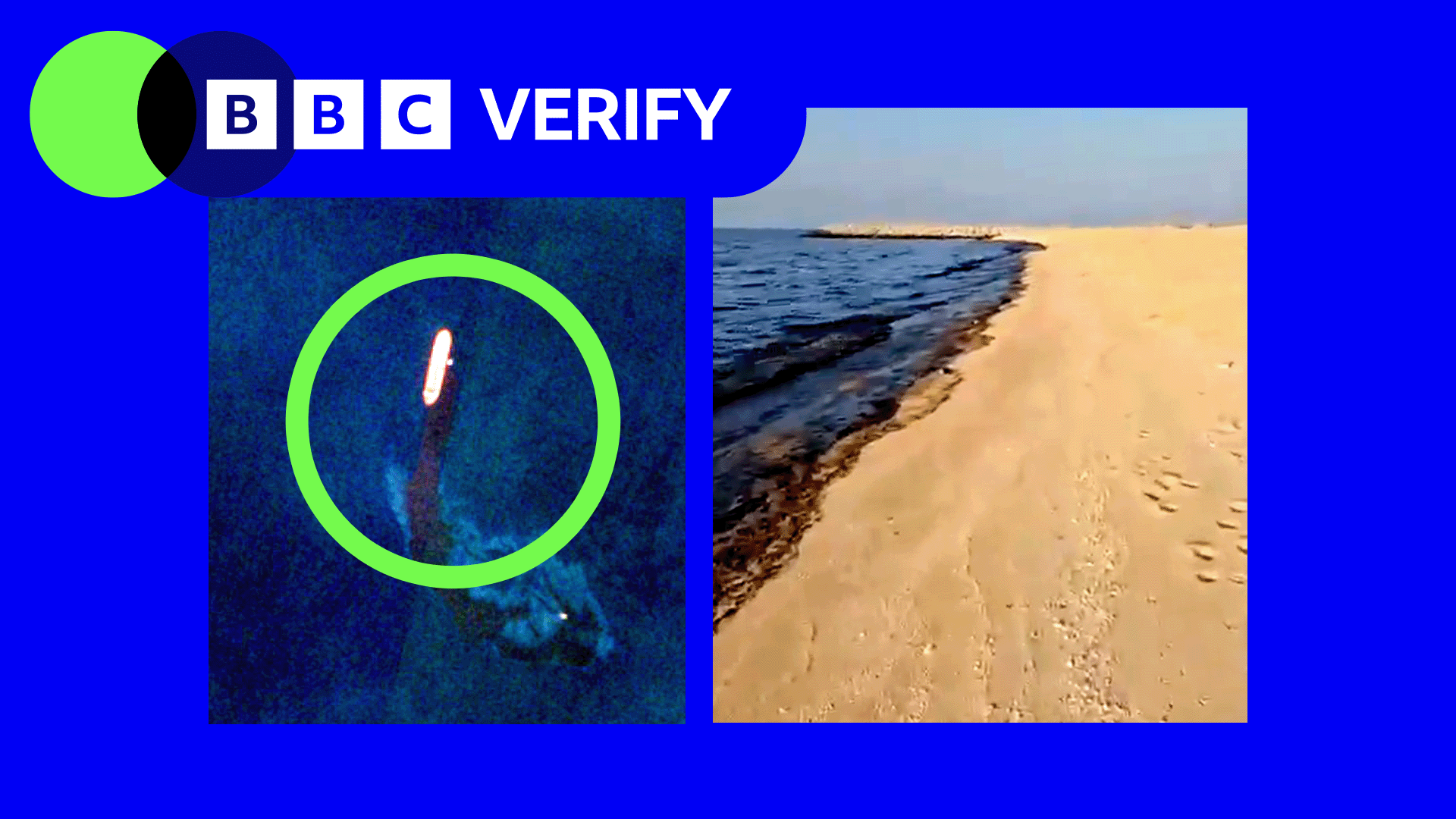
Within three days the oil slick has stretched more than 35 km (22 mi) along the UAE coast, washing up on beaches near the northern city of Umm Al Quwain. Authorities have closed affected beach areas and started containment operations to limit environmental damage.
The spill now threatens the Key Biodiversity Area around Siniyah and Khor Al Beidah islands, home to sea‑turtles, seagrasses, coral reefs and the critically endangered Halavi guitarfish. Marine scientists warn that the hydrocarbons can kill wildlife instantly or cause long‑term reproductive harm.
UAE officials say containment has begun, but experts caution that the ultimate impact will depend on the volume of oil released, its composition, evaporation rates and the speed and effectiveness of clean‑up efforts.
Images below show the darkness of the spill on the shoreline and the size of the slick as seen from satellite. The spread demonstrates the rapid pace of contamination in the Gulf following the tanker strike.