In brief
The intense summer of 2026 has left scorching marks across Western Europe, visible from orbit. Satellite data document shrinking glaciers, drought‑stressed fields, and widespread wildfires that intensified drought conditions. Rivers like the Danube have reached unprecedented low levels, prompting nuclear plants and shipping to halt. South‑west France has lost over 90,000 hectares to fire, and the Alps’ Rhône Glacier has retreated a metre per year. These images underscore the accelerating pace of climate change and the tangible damage it inflicts on natural and built environments.
The impact of this summer’s extreme temperatures on western Europe can now be seen from space after successive heatwaves since May.
Satellite images examined by BBC Verify show shrunken glaciers, scorched areas left by wildfires, green fields turned arid and lower river levels.
The Palace of Versailles appears as an island of trees surrounded by brown fields, underscoring how iconic landmarks are touched by the heat.
The EU’s climate monitoring service, Copernicus, has confirmed that western Europe experienced its hottest June‑to‑July period on record, driven by persistent high‑pressure systems and long‑term warming from fossil‑fuel emissions.
Rivers run drier: The Danube has dropped to its lowest level in 30 years, exposing the bones of a mammoth in Bulgaria and a sunken WW2 ship in Serbia. Heightened heat has forced nuclear power stations to shut down or reduce capacity, and Rhine cargo vessels have stranded.
Glaciers retreating in the Alps: Satellite imagery shows the Rhône Glacier’s front has retreated by about 50m since last year, pointing to a potential dramatic loss of alpine ice.
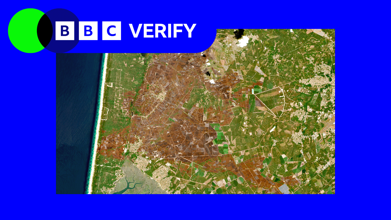
Wildfires have turned landscapes brown: Over 90,000 hectares burned in France, the worst year on record. The largest blaze in Gironde burnt 42,000 hectares, roughly the size of the Isle of Wight.
Normalized Difference Vegetation Index (NDVI) analysis shows 70% of France, near half the UK and 40% of western Germany experienced lower vegetation greenness this summer, indicating widespread water stress that threatens agriculture and food production.
These images are consistent with extensive water stress, warns Prof Andrew Challinor of the University of Leeds, highlighting that much of Europe’s crops may already have suffered damage.