Experts warn of flash flooding, mudslides, and dangerous surf conditions along the East Coast as Erin remains on its course past the Caribbean islands.
**Hurricane Erin Escalates to Category Five, En Route to North Atlantic**

**Hurricane Erin Escalates to Category Five, En Route to North Atlantic**
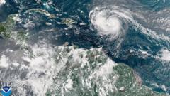
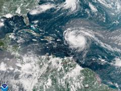
Hurricane Erin has rapidly escalated to a Category 5 storm with winds reaching 160 mph, creating serious weather concerns in the Atlantic.
Hurricane Erin has dramatically intensified, reaching Category 5 status with maximum sustained winds of 160 mph (260 km/h), following a significant upgrade from tropical storm strength in just 24 hours. Mike Brennan, the director of the National Hurricane Center, highlighted that Erin has "explosively deepened" overnight, marking it as the first hurricane of the Atlantic season in 2025.
Over the upcoming weekend, Erin is expected to pass north of the Leeward Islands and both the Virgin Islands and Puerto Rico, potentially delivering heavy rainfall of up to 6 inches (15 cm), raising concerns for flash floods and mudslides in the affected areas. Its path currently does not indicate a landfall on the US mainland.
The rapid intensification of Erin is noteworthy; the storm's winds surged from 100 mph early Saturday morning to their current peak of 160 mph within just a day. Next week, forecasters predict that Erin will continue moving gradually northward, navigating past the eastern Bahamas towards the Outer Banks of North Carolina.
National Hurricane Center officials have warned that Erin will create life-threatening surf and rip currents impacting nearly the entire eastern coastline of the United States by next week. The most hazardous conditions are anticipated for Florida and the mid-Atlantic states. Additionally, Bermuda is expected to experience perilous surf and substantial rainfall from the hurricane.
In response to the storm, the US Coast Guard has enacted restrictions on vessel movements in various ports, notably St. Thomas and St. John in the Virgin Islands, as well as in six municipalities across Puerto Rico, including San Juan.
The National Oceanic and Atmospheric Administration (NOAA) has already forecasted an "above normal" hurricane season for the Atlantic, with growing concerns that global warming could lead to an increase in the number of storms reaching Category 4 and 5 levels.


