MIAMI (AP) — A weather system currently forecasted to transform into Tropical Storm Imelda later today is creating disruption in the Bahamas and surrounding islands. This atmospheric event is anticipated to approach South Carolina as a hurricane early next week.
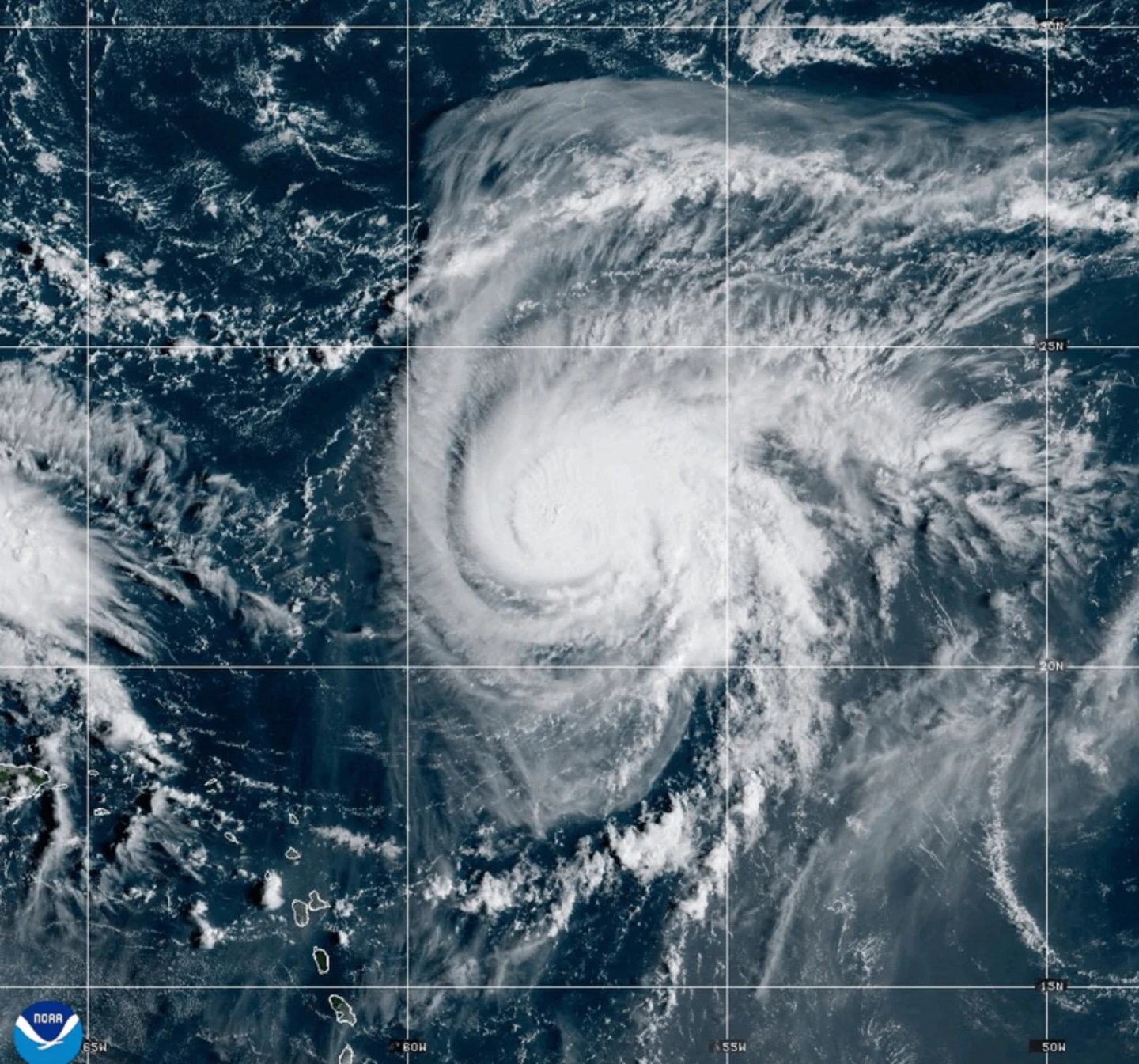
In parallel, Hurricane Humberto has slightly weakened but still poses a threat as a strong Category 4 storm in the Atlantic, endangering Bermuda.
South Carolina’s Governor, Henry McMaster, has urged residents to keep a close watch on the approaching storm, describing the situation as deadly serious during a recent news conference. Moreover, in neighboring North Carolina, Governor Josh Stein has already declared a state of emergency in anticipation of the system currently known as Tropical Depression Nine.
Forecasters predict that this system will evolve into a tropical storm later today and is slated to be named Imelda, potentially gaining hurricane status by Monday or Tuesday. At 0900 GMT on Sunday, the system was positioned roughly 100 miles (160 kilometers) west-southwest of the Central Bahamas, with maximum sustained winds recorded at 35 mph (55 kph) and a northern trajectory at 7 mph (11 kph).
What we learn every time is we never know where they are going to go, noted McMaster. The storm is expected to generate high winds and considerable rainfall, leading to potential flooding, prompting officials to preposition search and rescue teams over the weekend.
Hurricane Humberto Continues to Command Attention
Hurricane Humberto, with maximum sustained winds of 155 mph (250 kph), is still categorized as a significant storm. As of now, it is located about 585 miles (945 kilometers) south of Bermuda and is moving west-northwest at 13 mph (20 kph). The National Hurricane Center suggests that a tropical storm watch may be issued for Bermuda later today, and east coast swells are predicted to reach U.S. shores on Monday.
Meanwhile, Tropical Depression Nine is creating conditions ripe for heavy rainfall and potential flash flooding in parts of Cuba and the Bahamas, with some regions already under a tropical storm warning.
The Bahamas’ Department of Meteorology has advised residents in the northwest and central islands, such as Nassau and Long Island, to finalize preparations for the incoming storm as its center is expected to sweep across the area throughout Sunday.
Residents in low-lying areas should take precautions to protect their properties against flooding, the agency conveyed in a statement.
This tropical disturbance also impacted the Dominican Republic earlier this week, triggering evacuations and leading to red alert declarations in multiple provinces.
Pandemic Storms in the Pacific
In the Pacific, Tropical Storm Narda, which was once classified as a hurricane, is currently located about 1,045 miles (1,680 kilometers) west-southwest of Mexico’s Baja California Peninsula. Heading north at 5 mph (7 kph), it has maximum sustained winds of 60 mph (95 kph). Narda is generating swells that could culminate in perilous surf and rip current conditions along the Southern Californian coast, according to forecasters.