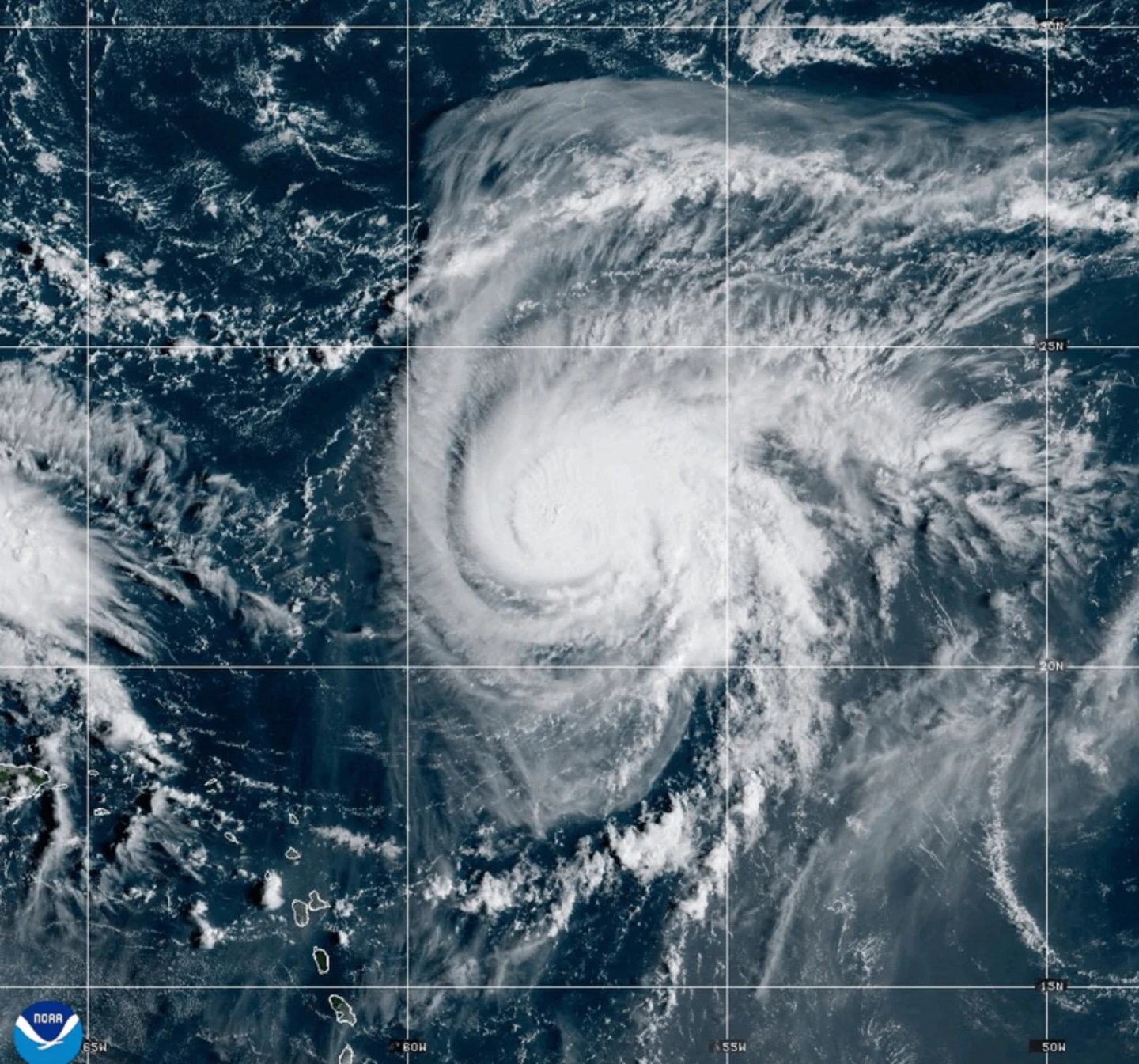
MIAMI (AP) — Dangerous tropical weather is intensifying in the Atlantic, with Hurricane Humberto growing into a powerful Category 4 hurricane, while another weather system threatens to become a tropical storm targeting the Southeast U.S.
On Saturday, the Miami-based National Hurricane Center reported that Hurricane Humberto boasts maximum sustained winds of 145 mph (230 kph) and is currently situated about 375 miles (605 kilometers) northeast of the northern Leeward Islands, moving west at 6 mph (9 kph).
Forecasters warn that Humberto could generate life-threatening surf and rip currents for the northern Leeward Islands, Virgin Islands, Puerto Rico, and Bermuda this weekend.
In addition, another weather system is forecasted to develop into a tropical storm while threatening parts of the Bahamas and Cuba with heavy rains and potential flash flooding, prompting tropical storm warnings for some areas.
The system is expected to head towards the Southeast U.S. early next week, with a gradual strengthening into a tropical storm anticipated by Sunday and further potential for hurricane status by late Monday.
South Carolina Governor Henry McMaster declared a state of emergency on Friday to facilitate coordination with local and federal authorities in preparation for any impacts.
In Charleston, preparations for potential flooding included assembling sandbags and checking emergency equipment as officials remain proactive amidst uncertainty around the storm's development.
The tropical disturbance has already led to severe flooding in the Dominican Republic, where heavy rains prompted evacuations and contributed to fatal landslides.
In related developments, post-tropical cyclone Gabrielle has moved away from the Azores, and while its hurricane warning has been lifted, dangerous surf conditions are still expected along parts of the Portuguese coast.
Meanwhile, Hurricane Narda exists in the Pacific, bringing coastal hazards potentially affecting areas from southern California to Baja California Sur.