MIAMI — Hurricane Humberto is expected to produce dangerous surf for Bermuda and the U.S. East Coast this week as Tropical Storm Imelda strengthens near the Bahamas, according to forecasters.
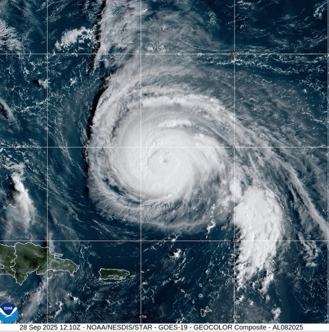
As of early Monday, Humberto remained a Category 4 storm in the Atlantic, prompting a Tropical Storm Watch for Bermuda, the National Hurricane Center in Miami reported.
At 2 a.m. EDT on Monday, Humberto was situated approximately 400 miles south-southwest of Bermuda, moving northwest at 14 mph, with maximum sustained winds of 140 mph. The storm is predicted to turn and accelerate east-northeast by late Tuesday or early Wednesday, with its intensity expected to fluctuate before weakening but remaining a dangerous hurricane for the upcoming days.
Meanwhile, Tropical Storm Imelda formed on Sunday and has been gradually strengthening. Reported at 2 a.m. EDT, Imelda is about 130 miles northwest of the central Bahamas, with maximum sustained winds of 45 mph, moving north at 8 mph. Heavy rains and potential flooding are forecast for parts of Cuba and the Bahamas, especially in the northwest and central islands.
The Bahamas’ Department of Meteorology anticipates rainfall amounts between 6 to 12 inches across various islands, prompting warnings for residents in low-lying areas to prepare for flooding. The usual bustle of New Providence was quiet on Sunday as constant rains flooded some roads and kept tourists away.
Flights in and out of the Bahamas faced numerous cancellations, although airports are expected to reopen once conditions improve. South Carolina's governor is taking precautions with search and rescue teams on standby, while North Carolina has already declared a state of emergency in anticipation of Imelda's impact.
As both storms continue to develop, residents are urged to stay informed and prepared as the situation unfolds.